Do You Need Survey Training? What Our Professional Training Covers
Here's a scene we see more often than we'd like. A contractor buys a good total station or GNSS receiver, takes it to site, and a few days later it's sitting back in its case. The instrument isn't broken. Nobody on the team is confident enough to use it properly.
Or a site engineer sets out a foundation with a tape and string line because "that's how we've always done it," and the building ends up a few centimetres off the plot boundary.
Neither problem comes from a lack of effort. It comes from a lack of training. Surveying equipment is only as good as the person holding it, and in Juba, where projects move fast and mistakes are expensive, good training pays for itself quickly.
This guide explains who needs survey training, what it should cover, and what to expect from the Professional Training we offer at Apex Surveyors.
Why Survey Training Matters
Modern survey instruments are powerful, and also easy to misuse. A few examples of what goes wrong without proper training:
- A GNSS receiver is used under tree cover and its readings are trusted anyway.
- A total station is set up over the wrong point, so every measurement that follows is off.
- Levels are carried from the wrong benchmark, so a floor ends up at the wrong height.
- Coordinates from different systems get mixed together, so nothing lines up on the drawing.
- Raw data is collected but never checked, so errors go unnoticed until construction.
Every one of these is avoidable. They're also expensive, because they usually show up after concrete is poured, a fence is built or a road is cut. Spending a few days learning the right way costs far less than redoing work.
Who Needs Survey Training?
You don't have to be a full-time surveyor to benefit. Training makes sense for a surprisingly wide range of people.
Site engineers and supervisors. If you're responsible for checking that the building goes up in the right place and at the right level, you need to understand setting out and levelling, even if a surveyor does the main work.
Contractors and foremen. Knowing how to protect benchmarks, read setting out marks and check your own work saves time and disputes.
Junior and assistant surveyors. Hands-on practice with real equipment, plus the theory behind it, is the fastest way to move from carrying the prism to running the job.
Graduates and students. Classroom knowledge and field skill are different things. Practical training bridges the gap and makes you more employable.
Architects and project managers. You don't need to operate the instruments, but understanding what they do helps you brief surveyors properly and read survey outputs with confidence. Our post on reading a topographic survey map is a good start.
NGO and government project teams. If you manage infrastructure, land or mapping projects, knowing the basics helps you plan realistic scopes and spot weak survey work.
Teams that have bought or leased equipment. If your team is about to use survey instruments independently, training should come first.
Signs Your Team Could Use Training
You probably need it if:
- Your instruments spend more time in their cases than on site.
- Setting out mistakes keep appearing after work has started.
- Survey data arrives in formats nobody on your team can use.
- You depend on one person who "knows how" to run the instrument.
- You're not sure how accurate your own measurements are.
- You're about to start a project that needs in-house survey capability.
- You've leased equipment and want to get full value from the hire period.
If two or more of those sound familiar, training is likely worth it.
What Good Survey Training Should Cover
Surveying is a broad field, so good training is built around the tools and tasks your team will actually use. Here are the core areas that matter most in the field, and the ones we work with every day.
Total station operation
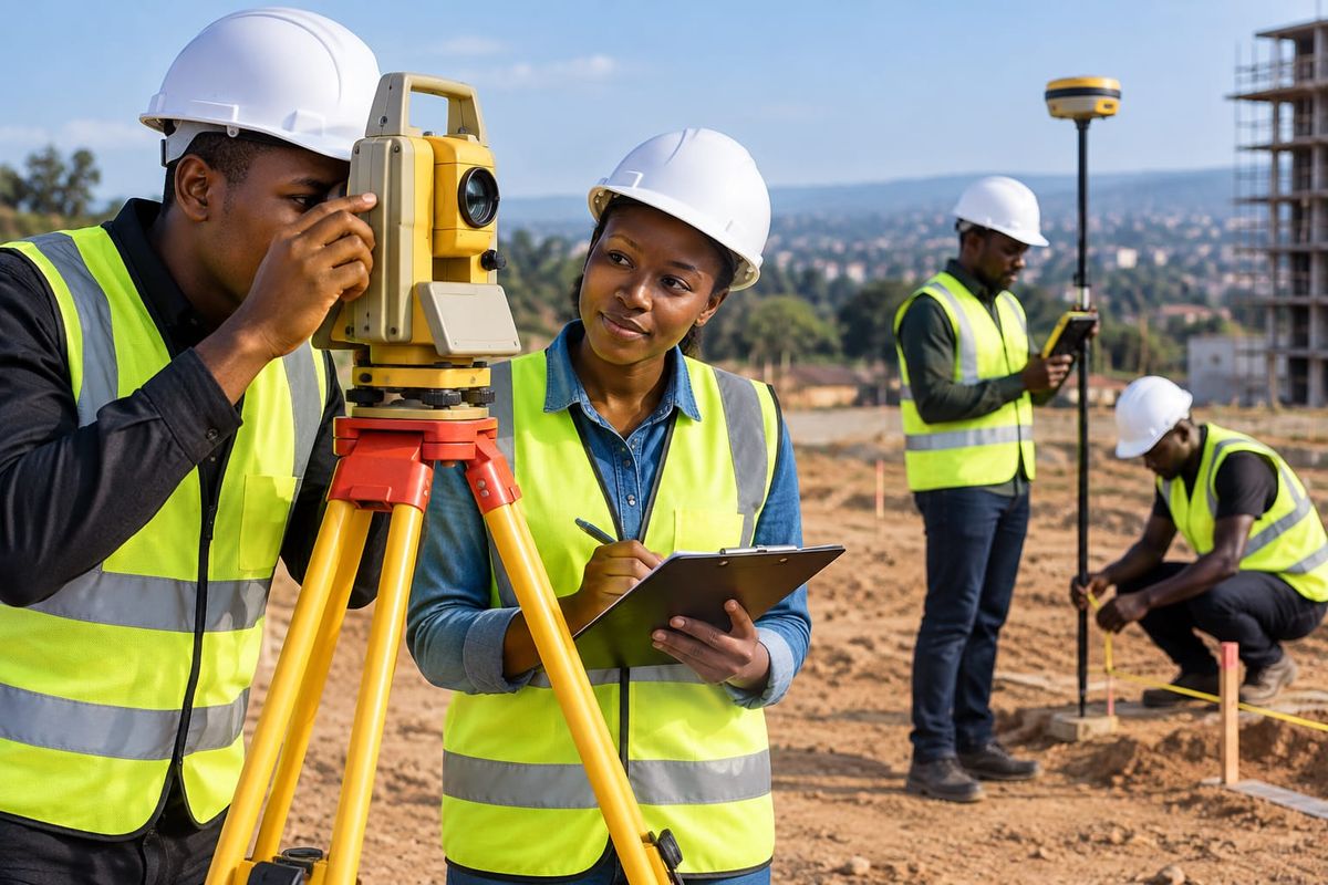
The total station is the workhorse of precise site work. Training should cover setting up and levelling the instrument, orienting it to known points, measuring angles and distances, and collecting and recording points. It should also cover resection (finding the instrument's position from known points), checking your setup, and recognising common errors. These skills are the foundation of accurate building layout.
GNSS and RTK surveying
GNSS receivers can fix positions to the centimetre in good conditions, and they save huge amounts of time on open sites. Good training explains how satellites and corrections work, how to set up a base and rover, how to check your fix, and how to spot trouble from tree cover, buildings and weak corrections. If you're unsure when to choose GNSS and when to choose a total station, our guide on RTK vs total station explains the trade-offs.
Construction setting out
Turning drawings into marks on the ground is one of the most valuable skills on any building site. Training should cover how to read design drawings, calculate and place gridlines and corners, set offset pegs and profile boards, transfer levels and check work as it progresses. Our article on construction setting out shows the process from start to finish.
Levelling and height control
Getting heights right is as important as getting positions right. Training should include using levels, carrying benchmarks across a site, recording and checking readings, and understanding datums so floors, drains and roads end up at the right height.
Topographic and boundary surveys
Learning to capture the shape of the ground and the position of features is core to site planning. Training should cover collecting detail and spot heights, coding features, and producing clean data for drawing. It's also worth understanding how boundary work differs. Our post on property, title and boundary surveys is useful background.
Coordinate systems and data handling
A lot of survey trouble starts in the office, not the field. Good training explains coordinate systems and datums in plain terms, how to transfer data between instrument, laptop and CAD, and how to check that everything lines up before it goes to the designer.
CAD, mapping and deliverables
Field data is only useful once it becomes a clear drawing or model. Training can introduce how survey data becomes plans, contours and sections, so your team can produce, or at least understand, the outputs clients expect.
Introduction to drones, LiDAR and GIS
For teams moving into aerial and digital methods, an overview of drone mapping, LiDAR scanning and GIS shows what these tools do and where they fit. See our posts on drone surveys in Juba, LiDAR in urban surveying and integrating GIS data with BIM for more.
Quality checks, errors and good habits
This might be the most valuable part of all. Training should teach how to check your own work: closing loops, repeating measurements, comparing against known points, and keeping clear field notes. Surveyors who check themselves catch problems early.
Equipment care
Good measurements depend on well-kept instruments. Training should include handling, transport, battery care, cleaning optics and basic calibration checks. Our guide to essential maintenance for high-precision GNSS gear covers the basics.
Why Hands-On, Local Training Works Best
Surveying is a practical skill. You can read about setting up a total station all day, but the first time you do it in the sun, with a breeze and a crew watching, it's a different experience.
That's why the best training happens mostly in the field, on real ground, with real instruments. It also helps when the trainers work in the same conditions you do. Surveying in Juba brings its own realities: rainy season access, changing site levels, patchy mobile coverage for GNSS corrections, security and site coordination. Learning from people who deal with those conditions every week means the lessons carry straight over to your projects.
At Apex Surveyors, our team has worked on 100+ projects across South Sudan, Kenya and Tanzania, covering everything from building sites to roads, bridges and power line corridors. Training draws on that real experience, not just textbook examples.
What to Expect From Our Professional Training
Our Professional Training service is built around practical skills your team can use on site straight away. In general, you can expect:
- Hands-on sessions with real survey instruments, not just slides
- Field exercises that mirror real site tasks, such as setting out a building and checking levels
- Clear explanations of the theory, in plain language, so the "why" is as clear as the "how"
- Focus on accuracy and checking, so you leave knowing how to verify your own results
- Training that fits your equipment and projects, whether you use GNSS, total stations or a mix
Because every team's needs differ, we tailor the content to your level and goals. A group of site supervisors will need something different from a team of junior surveyors preparing to run their own jobs. Tell us who's attending and what you'll be working on, and we'll shape the sessions around it.
Training Plus Equipment: A Smart Combination
If you're planning to bring survey capability in-house, training and equipment work best together.
Some teams lease instruments for a project and train their staff at the same time, so the people using the gear are ready from day one. Our post on why more surveyors and contractors in Juba are leasing survey equipment instead of buying explains when that makes sense. You can also see what's available in our equipment catalog or learn about our GNSS equipment supply.
If you'd rather not run surveys yourself at all, that's fine too. We provide full engineering surveying, topographic surveying and foundation setting out services.
How to Get the Most Out of Survey Training
A few habits make training far more useful:
Bring a real project in mind. Training sticks when you can connect it to a site you're about to work on.
Send the right people. Choose the staff who will actually use the skills, not only managers.
Train before the equipment arrives, or right as it does. Skills fade if there's a long gap between learning and doing.
Practise straight afterwards. Use the instruments on a small real task soon after training so the skills settle.
Write down your own procedures. A one-page checklist for setup, checking and recording helps the whole team stay consistent.
Plan a refresher. Short follow-up sessions help when new staff join or new equipment is introduced.
Common Mistakes Teams Make Without Training
Buying equipment first and thinking about skills later. Instruments don't fix a skills gap.
Relying on one person. If that person leaves, the capability goes with them.
Skipping checks to save time. It nearly always costs more time later.
Mixing coordinate systems or datums between the surveyor, designer and contractor.
Using GNSS everywhere, including places it can't work well.
Treating setting out as an afterthought. Foundations are the worst place to find an error.
Frequently Asked Questions
Who can attend surveying training?
Anyone who works with or manages survey tasks: site engineers, supervisors, contractors, junior surveyors, graduates and project teams. Sessions are shaped around the group's experience.
Do I need a surveying background?
Not necessarily. Training can start from the basics for beginners, or go deeper for people who already work in the field. Tell us your level when you enquire.
What equipment will I learn on?
Training focuses on the instruments used in everyday survey work, mainly total stations, GNSS receivers and levels. Let us know what your team uses or plans to buy so we can focus on the right tools.
Is the training practical or classroom-based?
Mostly practical. There's enough theory to understand what you're doing and why, and most of the time is spent using the instruments in the field.
Can you train my team on our own equipment?
In many cases, yes. Tell us what you have and we'll discuss how to build the sessions around it.
Can training be arranged for a company or NGO team?
Yes. Group training for company, NGO and project teams is a common request, and we can adapt the content to your projects.
How long does training take?
It depends on the topics and the group's starting level. A focused session on one instrument is shorter than a broader programme covering several skills. Contact us with your goals and we'll recommend a plan.
Will I be able to do my own survey after the training?
You'll leave with the skills to carry out the tasks covered, and know how to check your results. For complex or high-risk work, an experienced surveyor should still lead, and we're happy to support you.
Can I combine training with equipment hire?
Yes, and it's a smart way to start. Training your team while they have equipment on hand helps them get real value from the lease.
How do I book?
Get in touch through our contact page or call us, tell us who you'd like to train and what you'll be working on, and we'll suggest the right approach.
The Bottom Line
Survey equipment is expensive, and mistakes on site are more expensive still. Training is one of the cheapest ways to protect both. Whether you're a contractor wanting reliable setting out, a graduate building a career, or a team about to take on survey work in-house, practical, hands-on training gives you skills you'll use on every project.
Ready to build your team's survey skills? Learn more about our Professional Training, visit Apex Surveyors, or browse the equipment catalog. To discuss a programme for your team, get in touch or call +211 928 765 792.
Related reading: Construction setting out explained · How to read a topographic survey map · Leasing survey equipment in Juba · More on the Apex Surveyors blog