Ask three surveyors whether RTK or a total station is better, and you'll probably get four opinions. The honest answer is that it depends on the job.
That answer isn't very helpful if you're a client trying to understand why your surveyor showed up with one instrument instead of the other. It isn't much help either if you're a contractor weighing up whether to buy, lease or simply hire a surveyor for the work.
So here's a plain-language guide. We'll cover what each instrument does, where each one shines, where it struggles, and how to choose. It works whether you're on the surveying side or the client side.
First, What Are We Comparing?
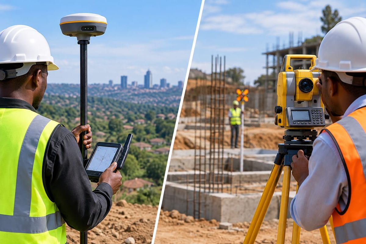
RTK GNSS (Real-Time Kinematic Global Navigation Satellite System) uses satellite signals plus a correction source to fix positions in real time, often to within a couple of centimetres. A receiver on a pole, called the rover, picks up satellites. Corrections come from a nearby base station or a network. The surveyor walks around, holds the pole on a point and gets coordinates on the spot.
A total station is an optical and electronic instrument on a tripod. It measures angles and distances to a prism or reflective target (or directly to a surface in reflectorless mode), then calculates the position of each point. It doesn't rely on satellites for measuring, but it does need to be set up over a known point or oriented using known references.
Same goal, completely different ways of getting there. That difference drives everything else.
RTK GNSS: Where It Shines
Open sites and big areas. Because RTK needs no line of sight between points, a surveyor can walk across a large plot and pick up thousands of points quickly. For wide, open land, it's hard to beat.
Speed with fewer people. One surveyor with a rover can cover a lot of ground alone. A conventional total station job often needs a second person holding the prism, unless you use a robotic setup.
Working in real coordinates. RTK gives positions in a proper coordinate system without needing existing control points nearby. That's handy for establishing control, tying a site into a national or project grid, and working across long corridors.
Long, linear projects. Roads, pipelines, power lines and other corridors suit RTK well because you can keep moving without re-setting up. Our post on route surveys for roads, power lines, railways and more explains how these projects run.
Boundary and fence work on open land. Finding and marking boundary points across open plots is quick with RTK.
Where RTK struggles
Poor sky view. GNSS needs a clear view of the sky. Under thick tree canopy, beside tall buildings, inside structures, in deep cuttings and under bridges, signals get blocked or bounce around. Accuracy drops, and in the worst cases the receiver can't get a reliable fix at all.
Correction source. RTK needs corrections to reach centimetre level. That means setting up a base station or having a reliable network connection. Where mobile coverage is patchy, a local base is the usual answer.
Height is the weaker axis. RTK is typically more precise horizontally than vertically. Vertical accuracy is usually fine for topographic work but may not satisfy tight level control for structures.
Not for indoor or underground work. If you can't see the sky, you can't use it.
Total Station: Where It Shines
Highest local precision. Total stations measure angles and distances very precisely over short ranges. When the job needs millimetre-level agreement between points, such as building corners, column positions and structural elements, the total station is the reliable tool.
Works where GNSS can't. Inside buildings, under canopy, in tight urban sites, under bridges, in tunnels and shafts, a total station keeps working as long as it has a clear line of sight.
Construction setting out. Marking foundations, gridlines, columns, ground beams and floor positions is the classic total station task. We explain the process in our guide to construction setting out.
Reliable heights and levels at a local scale. For tight vertical control on a site, a total station paired with a level gives dependable results.
As-built checks. Verifying what was actually built against the design, down to small tolerances, is a strength. Read more in our post on why as-built, existing and final surveys keep projects accountable.
Where a total station struggles
It needs line of sight. Every shot needs a clear path between the instrument and the target. Tall grass, vehicles, workers, stockpiles and fences can interrupt it.
It's slower over big areas. Each setup covers a limited radius. Covering a large site means moving the instrument many times.
It needs known control. The instrument has to be tied to known points or a set coordinate system before the data means anything on the wider map.
Usually needs two people. A surveyor on the instrument and a holder with the prism, unless a robotic total station is used.
Weather and conditions matter. Heat haze, heavy rain and dust can affect long measurements and visibility.
So Which One Should You Use?
Here's a simple way to decide. Ask four questions.
1. What's the environment like? If the sky is open and the ground is clear, RTK is likely the faster option. If there are trees, buildings, structures or indoor spaces, lean towards a total station.
2. How big is the area? Large plots, long corridors and wide-area mapping favour RTK. Small, tight, detailed areas favour a total station.
3. How tight is the tolerance? For topographic mapping, boundary pegs and general site work, RTK accuracy is usually fine. For structural setting out and precise as-built checks, a total station is typically the safer choice.
4. What's the job? Different tasks suit different tools. A rough guide:
- Topographic surveys on open land: RTK, often with drone data for large sites
- Boundary and subdivision pegging in open areas: RTK
- Establishing control points: RTK, then checked with a total station
- Building setting out and foundations: total station
- Interior surveys and as-builts: total station
- Road and pipeline corridors: RTK for the corridor, total station for structures like culverts and bridges
- Urban sites with tall buildings: total station, sometimes with RTK on open edges
- Quick stake-out of points across a large site: RTK
If you're unsure what a topographic survey involves or how to read the result, our guide to reading a topographic survey map is a good companion.
The Real Answer: Use Both
On most serious projects, RTK and a total station aren't rivals, they're teammates.
A common workflow looks like this. The surveyor uses RTK to establish site control quickly, placing reliable reference points in real coordinates. Then a total station takes over for the detailed, structural or obstructed parts of the job, working from those control points. Finally, RTK or the total station is used to check results and confirm everything matches.
That combination gives you the speed and reach of GNSS with the local precision and flexibility of optical measurement. It's the approach we lean on for projects that mix open ground and built-up areas.
Aerial methods add another layer. For very large or hard-to-reach sites, drone mapping can capture a huge amount of data quickly, with RTK or ground control points keeping it accurate. Our post on drone surveys in Juba covers when drones make sense and when ground surveys are still essential.
Accuracy: What the Numbers Mean
Instrument brochures quote accuracy figures, and they're worth reading with a little caution.
RTK accuracy is usually stated as a small fixed value plus a part per million that grows with distance from the base. In good conditions, you can expect centimetre-level results, and it gets worse under poor sky view, with weak corrections or with long baselines.
Total station accuracy is usually quoted for angles (in arc seconds) and distances (in millimetres plus parts per million). In practice, results depend on careful setup, good targets, calibrated equipment and the operator's skill.
The point is that stated accuracy is a ceiling, not a guarantee. Real accuracy comes from method, checks and experience. A good surveyor will tell you what tolerance applies to your job and how they'll verify it.
Cost and Practicality for Contractors and Clients
If you're thinking about equipment rather than hiring a surveyor, a few practical points apply.
RTK kits are often attractive for teams doing lots of open-site work, since one person can collect data efficiently. But you also need the corrections setup, training and a plan for areas with poor sky view.
Total stations are the right tool for contractors doing their own setting out and checking. They also demand more training to use correctly.
Both need care. Calibration, battery management, clean optics and proper storage keep them accurate. See our guide to essential maintenance for high-precision GNSS gear.
Buying isn't always the smartest move. If you only need equipment for a single project or a season, leasing can save a lot of money and avoid tying up capital. We explain the thinking in why more surveyors and contractors in Juba are leasing survey equipment instead of buying. You can also browse what's available in our equipment catalog.
Skill matters more than the box. An excellent instrument in untrained hands gives poor results. If you don't have a trained operator, hiring a surveyor or booking professional training is often the better investment.
Common Mistakes
Using RTK under canopy or next to tall buildings and trusting the numbers. Always check results against known points when sky view is poor.
Skipping control checks. Whichever instrument you use, check it against a known point before and after the work.
Setting up a total station over an unchecked point. A small error in the setup carries into every measurement that follows.
Ignoring the datum and coordinate system. If the project, the surveyor and the designer don't agree on these, even perfect measurements won't line up.
Choosing the instrument by habit. Pick the tool the job needs, not the one you're used to carrying.
Assuming newer means better. The best instrument is the one that suits the conditions and is properly maintained and operated.
Frequently Asked Questions
What is the main difference between RTK and a total station?
RTK uses satellites and corrections to find positions in real time, and it needs a clear sky view. A total station measures angles and distances optically from a tripod, and it needs a clear line of sight to each target.
Is RTK more accurate than a total station?
Not usually. Total stations are generally more precise over short distances, especially for structural and detailed work. RTK gives good centimetre-level accuracy and is far faster across large open areas.
Can RTK replace a total station?
On open land, often yes, for tasks like topographic mapping and boundary pegging. For setting out buildings, working indoors or surveying under canopy and around tall structures, a total station is still essential.
Which is better for construction setting out?
A total station is the usual choice for foundations, columns and structural elements because of its precision and ability to work in obstructed areas. RTK is useful for site control and for marking out large open areas.
Which is better for topographic surveys?
RTK is typically faster and more efficient on open ground. A total station helps in areas with obstructions or where extra detail is needed. Large sites can also use drone mapping.
Do I need a base station for RTK?
Usually you need a correction source, either a base station you set up or a network of reference stations. Where mobile coverage is weak, a local base is the common solution.
Can I use RTK in Juba?
Yes. Open areas work well. Dense tree cover and built-up areas can limit it, and mobile coverage affects network corrections, so many surveys use a local base. A surveyor familiar with local conditions will plan around these limits.
How many people do I need to operate each one?
An RTK rover is typically operated by one person. A standard total station usually needs two, one on the instrument and one holding the prism, unless it's a robotic model.
Should I buy, lease or hire a surveyor?
If you need equipment regularly and have trained staff, buying can make sense. For one-off or seasonal projects, leasing is often cheaper. If you don't have the skills in house, hiring a surveyor gets you accurate results without the learning curve.
How often should survey instruments be calibrated?
It depends on the manufacturer's guidance, how heavily the instrument is used and the accuracy your work requires. Regular checks and servicing are standard practice for professional equipment.
The Bottom Line
RTK and total stations aren't competitors, they're different tools for different conditions. RTK is fast, efficient and great for open ground and large areas. A total station is precise, flexible and essential for structures, tight spaces and detailed work. The best surveys often use both.
If you're planning a project in Juba and aren't sure which approach your site needs, talk to us. We provide topographic surveying, engineering surveying, GNSS equipment supply and leasing, and professional training, backed by over ten years of experience and 100+ completed projects across South Sudan and East Africa.
Visit Apex Surveyors to learn more, browse the equipment catalog, or request a survey. You can also call +211 928 765 792.